No specific info about version 2.2. Please visit the main page of GeoScan32 on Software Informer.
C-GEO enables importation of survey data from geodetic instruments.
Workflow solution for geological modelling.
It can analyze and trace all network applications on the fly
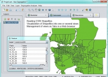
An open-source program that can read ESRI Shapefiles.
Plot geotagged images in a selected folder on a virtual globe

Comments